Tuesday, December 9, 2008


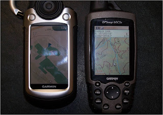
Final Class- Well I think I accomplished what I set out to do and that is to know more than when I came into the class. I guess the most valuable item I got out of the class was the direction Pete led me to making my own maps for the Garmin GPSs. It is still a work in progress but it is definitely improving every day. Being able to put layers of all the USFS trails and different contour lines is proving invaluable to us. We are even able to put our hydrant point files on the GPSs. I was even able to add the .shp files for the AB Tech buildings on the GPS.


I think I did improve on how to make color schemes work on maps and learning annotations is a valuable tool. I hope I will be able to keep up in 215 next semester.

Tuesday, November 18, 2008

Working with Styles


Well I got the basic concept of this. But I'm not sure if I like it. I thought the colors in ARC Map were just fine and easier to work with. Oh well here is some of the work from this project.

Drawing and Symbolizing Features Cont.


This is my Challenge Map

Drawing and Symbolizing Features Cont.


Exercise 8 and 10

Drawing and Symbolizing Features Cont.

Exercises 4-7


Drawing and Symbolizing Features


Well, I finally got through with my project that was due last week for the Drawing and Symbolizing Features. This is exercise 1 and 2 pdf maps.

Friday, October 3, 2008

Zoomed Bunc Bike Map


Bicycle Map Pic


Well for the most part I think I am through with my map until I get to print it in class. I tweaked it a little bit over the past few days but I feel like I learned quite a bit while making this map. The annotation layer was the newest item to get used to but I am even starting to feel a little comfortable with it. I even through trail and error figured out how to copy and paste my road symbols. I found out when you copy and paste it just pastes the symbol over top over the original symbol, so all you have to do is click on the symbol and drag the newly pasted symbol to wherever you want to. I'm still not really happy with my color scheme of my title, legend and reference bar. Oh well, maybe I can tweak than next class.

I did also find some interesting news through a contact Pete introduced to me that works for the Buncombe County GIS Dept. I have been working with her to try to get the .shp files of the Bent Creek Trails on the 911 CAD map. She has been very helpful and we are progressing nicely. I did talk to her this week and she told me to look on the Bunc. County GIS web site, that they had just put the trails on the site within the centerline data of the streets. Low and behold when I pulled up the streets there they were. Cool. There are even some of the trails on the downloadable Bunc. County centerline data, but not all of them. Look forward to seeing everyone's map on tuesday, so I can see what I can do to improve mine. Alot of smart, talented people in the class and I am still a little intimidated by you guys, but it has made it great learning enviornment. So thanks.
Tuesday, September 30, 2008

Bicycle Map


Just got through with my rough draft of my bicycle map. Now I got to study a little bit for the test tonight. (Missed last week).

Tuesday, September 9, 2008

Mapping Batch Geocode


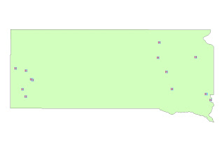
Sometimes you have to be careful what you learned in class, it just might suck you into a black hole as it did me this past week. I was asked at the end of last week if I could do a report for the fire department I work for which would give the data of how many runs we have had in the Cliff's development this year. The light bulb clicked almost immediately. I could create a crystal report giving the addresses of our runs in our district 2, which is where the cliffs is located. I could then take that report and export it to an excel file. I then copied that excel file and pasted it in the program Pete had shared with us last week, batchgeocode.com. The batch geocode.com did not like that I had enter 600 addresses it said no more than 500 should be entered. So I went back and copied 500 and enter those. It ran very quickly until it got to #400 and then it went to a crawl. It finally finished up and I had my x & Y data enter that data into a map I had already started creating and away we went. My next problem was getting the street labels to look clean. I never did quite accomplish that. Attached you will see my unfinished product. Maybe I will learn more tonight to clean up this project.


Friday, August 22, 2008

1st GIS 121 Map


Here is my first GIS 121 Map. A map on the Leaf International World OUTREACH Locations.

Tuesday, April 22, 2008

DOT LIDAR Map Projection


Here is my work from my 4/17/2008 class. Pretty interesting stuff, making hillshades, slopes, aspects and etc.

Wednesday, April 16, 2008

Spatial Analyst Homework

The homework for 4/17/2008 was working with Spatial Analyst. The homework was pretty straight forward but pretty time intensive. Spatial Analyst is a really neat tool in the tool box. It is one that I can see us using here at the fire department quite a bit to project fire hazard areas, flood rescue potential areas, response areas and many more. I am definetly saving the tutorial to guide me through future projects.

I am also looking forward to the practical exam tomorrow night (Just Kidding).

4/10/2008 Home Work Maps


Thursday, April 3, 2008

Wednesday, March 12, 2008

3/6/08 Class

Good to see you back Pete. It's amazing how I find myself already using what I have learned in class in the real world. I was looking at the Mt Everest region on Goggle Earth the other day and now I understand why the area right around Mt. Everest is a rectangle and the other areas just west of there are not. Sattelite imaging versus thematic. I don't even try to zoom in now in the thematic areas where I always did in the past and did not realize why it was so distorted where as the sattelite imagery is pretty clear as we zoom in. Thanks again for the help with the attribute tables also.

Chapter 8 & 9 Maps


Thursday, February 28, 2008

Module 6 Georeferencing

Great Exercise. I enjoyed georeferencing the Bent Creek Trail Map. I did my feature classes a little different in that I made a feature class for each trail type, that way I could assign each type of trail a different color. I also had downloaded a Buncombe County Topo Map from the NCDOT site that needed to be georeferenced and I was able to do it from the instructions from the lecture. I would like to play a little bit more with the attribute table to be able to create a legend with the trail names and numbers.

Module 6 Maps


Thursday, February 21, 2008

Video Casts of Module 5

Enjoyed the first video cast, easy to follow and informative. The video cast on Intor to Editing in ARC GIS did not have sound with it, could kind of follow it though.

I downloaded a topo map earlier this week from DOT, it had coordinates that I could not figure out. I am going to try to play with what I learned in the video cast and see if I can create known points on the map and then georeference it.

Chapter 16b Maps


Chapter 16b Maps


Chapter 16a Maps


Tuesday, February 19, 2008

Valentine's Class

The test was a good one. Not to say I did well, because I really hit a brain block on two of the last three questions. Bottom line I am still learning a wealth of info in the class. Showing me how to do file conversions has been the most help for this week. Hope mexico is sunny and warm.

Chapter 15


Chapter 15


Chapter 15


Monday, February 11, 2008

Class #3 Journal

The more I sit and listen to Pete the less I realize I do not know about mapping. I really learned alot about coordinate systems and geodesy during class #3, but what I learned the most was how much I did not know. I can't wait to start working on our local maps.

Chapter 19 Map


Goode Map


2/3 Bagel Map


Monday, February 4, 2008

Chapter 14 Map Data


Chapter 13B Map


Another great fast paced class. I learned enough to be able to access and actually use some of the GIS data we have for the fire department. I hopefully will have enough time to actually make some maps to use in class. Looking forward to Thursday.

Thursday, January 31, 2008

Journal

Slowly but surely figuring this post thing out. Having more trouble figuring it out than I did the homework, which was pretty straight forward.

Tuesday, January 29, 2008

Chapter 4 Maps


Chapter 4 GIS 111 Maps. Finally got to work on my homework this morning. It took me a few days to figure out which computer to load the ARC GIS software on. I choose my work desktop because it has 1g of ram and my home only had 512, and I can remote desktop my work from home, making it possible to work from both locations. I'm still not sure if I have done everything I needed to in my blog site. So far The Getting to Know ARC GIS is pretty straight forward.

Thursday, January 24, 2008

Chapter 3 Maps


Here is the chapter 3 maps